
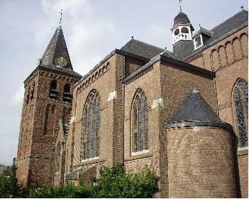
Austria
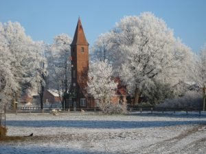
Lassee
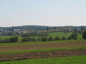
Lassee is situated in the eastern part of Austria, right between Vienna and Bratislva. There are two villages belonging to the municipality, Lassee and Schönfeld.
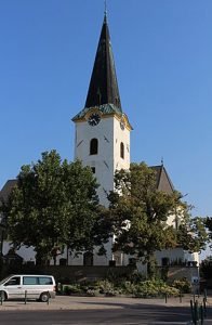
The total area of the municipality is 55,62 square kilometres, and the number of inhabitants living in Lassee is around 2700 people. Many of them are farmers or work in Vienna.
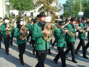
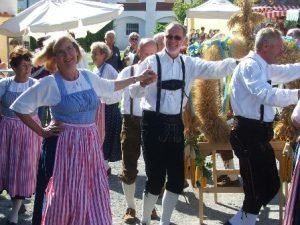 In Lassee people can spend their free time in one of many associations like sports clubs, music group or theatre group.
 Lassee was mentioned for the first time in 1115 and it was called at this time Lauchsee.
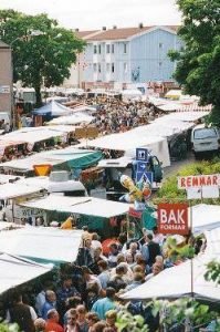
Since 2004 Lassee is member of the Charter and in 2007 the so called Europapark was opened. In this park you can see pictures from each municipality belonging to the Charter.

Belgium
Bièvre
The municipality of Bièvre with its twelve picturesque and peaceful villages is situated at an altitude of 348 meters on a plateau of the Belgian Ardennes in the south of the province of Namur. The municipality lies in the valley of the rivers Semois and Lesse, on the main road halfway between Beauraing (pilgrimage) and Bouillon (famous castle).
Bièvre attributes its name to the beaver which you will find on the armorials bearing, the flag as well as on the weather vane on the top of the Town Hall.
 Bièvre is famous for and very proud of, its wonderful Town Hall with its large library and Cultural Centre. The building used to be a hunting lodge and the Cultural Centre is now located in the old stables for horses and hunting dogs. The library celebrated its tenth birthday in 2013. Aware of the importance of the literature, in our rural district far away from the cultural and literary centres, the municipality decided to create an infrastructure available to the citizens and particularly to the young people. Our library counts more than 15000 works and welcomes about 500 readers every year. More than 5000 books are read every year. Our Cultural Center is a place for meeting and cultural exchanges. Varied activities such as shows, entertainments, exhibitions, conferences and so on, are proposed. In brief, moments of relaxation and user-friendliness.
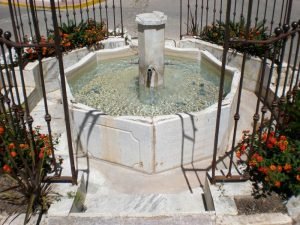
The municipality has a rich architectural heritage with for example: the fountain of St Furcy in Bellefontaine, the tower of St Denis’s Church and the Chapel in Oizy, but also old public washtubs in the middle of the villages, where women used to do the laundry.
 Bièvre has approximately 3200 inhabitants. In former times it was an agricultural community which for a large part provided its own needs. Nowadays most people work in offices or in factories in and around Bièvre. Bièvre has developed economically and has now an industrial park where several small factories have established themselves.
Six villages have a local primary school, where children are taught from two and a half years old up to twelve years old. Afterwards the students go by bus or by train to the middle and secondary schools in the surrounding area. There is also a train station in Bièvre that lies on an important double track line for the transport of travellers and goods.
 In the municipality, the inhabitants have a wide choice for leisure activities. There are two football clubs and if you do not like football, you can play tennis, table tennis or practice horse riding, mountain biking, gymnastics, modern dance or paintball. There is also an art class where children and adults can learn how to paint and to sculpture. A local theatre group performs one play every year.


Croatia
Tisno
Tisno was named after the Croatian word Tisno which means strait, which describes its location at the narrow strait separating the island of Murter from the mainland.
The municipality extends both to several other villages on the island as well as several nearby villages inland. In the 2011 census, there were a total of 1,287 inhabitants in Tisno.
Tisno was first mentioned in 1474 during the Turkish invasion and during the war against the Venetians when numerous refugees fled to Tisno to seek shelter.
Many historical sites tell us about the settlement of this area. The remnants of a Roman villa in Ivinj date back to the 1st AD. The site was awarded the status of a protected cultural monument.
Tisno has incredible Dalmatian stone houses and narrow streets, wide squares and widespread Mediterranean vegetation along with a long seafront and many traditional restaurants make Tisno an enjoyable environment.
 Tisno is situated partly on mainland and partly on Murter island. What separates them is a small bay, only 38 meters wide. It is the youngest island resort. Connection between land and island is a mechanical bridge that opens twice a day during summer season. Local people started constructing a bridge right after the breakdown of Republic of Venice but soon after they started, local people from other villages protested against it and building the bridge was once again put off. However, constructing started soon again and the bridge was finally finished and remains as it today. What needs to be pointed out is that Tisno had municipal government from 1808 until 1962 when Šibenik County took over. But, after Croatia became independent country in 1993, authority has been established again. Other villages became a part of Tisno borough until 1997 and 2000 when Pirovac and Murter extracted.
In 19th and 20th century Tisno was centre of administration as well as trade and dealership, particularly between two world wars. More traditional activities were vine and olive cultivation. Tisno was also the first village to open up to tourist activities which resulted organized tourist visits and opening boarding houses and a hotel.
Tisno today is much different. Although it is still a centre of administration, trade and dealership it is not as emphasized. Local population is still engaged in agriculture but with minimal results. On the other hand, tourism is main activity. Tisno has hotels, apartments, luxury rooms and camps. New regional plan is to include some interesting localities turning them into apartment villages, eco sections and auto-camps. Jazina and Rastovac zone is in plan for building hotels while Luka cove and east side of Tisno are predicted to become nautical marina. Significant resource is therapeutic mud at the Makirina cove and that is important for improving health tourism.
Amongst historical mouments the old bridge was built at the beginning of 18th century and was replaced with mechanical bridge in 1968. It is the only connection between the island and the mainland. The bridge was reconstructed many times. It used to open manually and sideways. Frequent transportations were donkeys that were sometimes afraid to cross because of the gap between the boards.
Veneration of Our Lady of Karavaj at the shrine began in Italy in 1432 on May 26th in town Caravaggio near Bergamo when apparition occurred. Woman called Ivanica saw Our Lady. During 17th and 18th century many Italian families moved from Bergamo to Tisno. Among them was family Gelpi who brought a picture of Our Lady. They built a small chapel on hill Brošćica in 1720 and owned the chapel for more than 250 years when they decided to hand it over to the local district along with its terrain and votive gifts. On the same date every year Tisno celebrates The Feast of Our Lady of Karavaj by organising pilgrim’s journey.
Archaeological excavations at the church of Saint Martin revealed the walls of villa complex dating back to the 2nd and 3rd century. Furthermore, remains of basilica from the 5th century, altar, early Christian baptistery and 900 tombs from the 15th century have been found. Archaeologists are still searching this area for a cemetery..

Cyprus
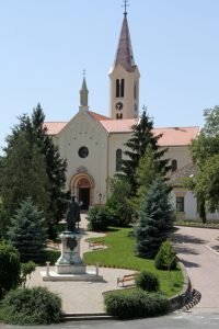
Lefkara
Lefkara is situated at an altitude of 650 meters, southwest of the Troodos Mountains. Lefkara lies in the heart of Cyprus, because it is only 50 km away from Nicosia, 35 km from Larnaca and 55 km from Limassol. The population is around 1000 people and the size of the municipal area is 60 square kilometers.
The dry and healthy climate, the hospitality of the people, the beauty of the landscape and the art of embroidery are only a few reasons to visit Lefkara. The name of the village comes from the surrounding mountains: Lefka Ori, White Mountains.
Historical sources show that the different conquerors of Cyprus have left their spurs in Lefkara. In the period of the Franks, Lefkara was the seat of the bishop of Amathus. Under the authority of Venice, Lefkara became a sanctuary for women from Venice. According to the legend, these women taught the local population to embroider. During this period, the famous Leonardo da Vinci reputedly visited Lefkara and the legend says he bought a big tablecloth for the altar of the Milanese cathedral.
 Around 1570, when the Turks invaded Cyprus, Lefkara was a shelter for many refugees. The English conquerors gave Lefkara the status of municipality in 1883. In the centre of the village is the church of the Holy Cross, built in the fourteenth century. Every corner of Lefkara is linked with Christianity. Every neighbourhood has its own historical chapel where also nowadays services are being held. In Lefkara the visitor can experience the spirit of the past all over the village.
 During the year, many cultural events take place. Most well-known is the annual festival of Lefkara in August. Famous Cypriot and Greek artists ensure an unforgettable program and the visitor can enjoy the traditions and local uses, figured in dances, songs and plays. A regional centre for athletics is available for many sports and the surroundings of Lefkara is suitable for beautiful nature walks. You cannot find the words to define the beauty of Lefkara, you have to experience it yourself!

Czech Republic
Starý Poddvorov
The history of the village dates back to the 13th century where it is mentioned as one of the 63 settlements of the region. The first written (mention) reference about the anonymous village of Potvorov dates back to the year 1704 and since 1924 it has got its current name
The settlement developed from wine cellars under vineyards which is backed up also by a seal from the year 1779. As the history suggests it was an agricultural village orientated predominantly on grapevine growing which is kept up to the present. In the 1940s oil extraction started in the very near surrounding.
With its location at an altitude of 220-250 metres and less than 1000 inhabitants it ranks among middle-sized village.
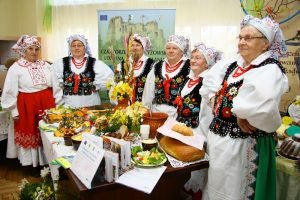
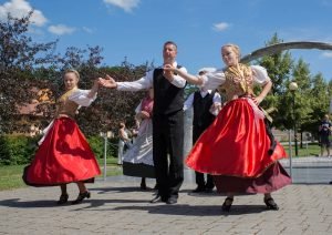
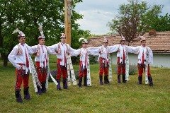 The rich folklore still exists in the region that springs to life during numerous feasts and festivals. In the middle of June we can experience a two-day long children´s festival. This children’s folklore show is international in scope. (The children’s ethnographic ensemble Kordulka (“a special vest that is part of a folk costume”) was established in 1996. It is connected with the traditions of the village, in particular with the Children’s feast in folk costumes and the singer’s competition.)
 And also every first Sunday in August there is the traditional feast celebrated in Starý Poddvorov.
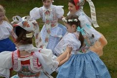
In the field of folk creativeness the village is renowned for its folk costumes embroidery. The local diligent women create the beauty of shirts, special sleeves and aprons.
 Another tradition that was preserved in our village is the engraving of Easter eggs. The technique of ornament creation and dying is kind of “trade secret” of every author.
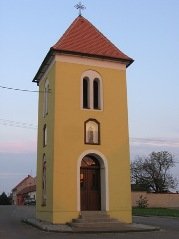
Several architectural sights in our village deserve your attention. The bell tower built in 1885, dedicated to St. Martin, dominates the village. The modern church from 1994 bears the same name. There are number of small religious objects located around the village such as pictures, crucifixes and chapels.
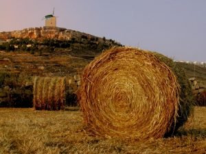
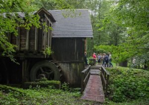
 But the main monument to see is the all-wood windmill of the ram type from 1870. It was restored in 2003. Its interior shows how flour was produced in the past. It stands on a hill just three kilometres from the village. According to a legend it was built by a citizen of the neighbouring village, who got rich thanks to finding a military treasure.
 In the last decade the village underwent an intensive development in the field of infrastructure and services for its inhabitants. The village paid attention to (affording opportunities for) stabilization of its inhabitants by building flats for young families.
Wine and cycle paths go through the village and its surroundings and attract people to visit this area. If you visit Starý Poddvorov, you will meet helpful hospitality of local citizens.

Denmark
Næstved
The impact of the amalgamation of 275 municipalities into 98 new bigger ones, Holmegaard became from 2007 part of Nastved Municipality. The new municipality was merged with 3 other smaller municipalities and the town of Naestved. The new municipality has a surface of 684 square and in 2015 81.800 inhabitants, of which half are living in the countryside and the other half in the town. Holmegaard has been member of the Charter from the beginning in 1989, and the membership has from 2007 been transferred to Naestved.
 Naestved is called the capital of South Zealand as Naestved is the center of trade, business, education and retail centers, which servicing the south part of Zealand. Naestved is a traffic hub for public transport as trains are connecting Naestved to Copenhagen and Sweden. Several times a day direct trains connect Naestved to Hamburg in Germany. Public buses and trains are servicing the countryside during the day.
Close to Naestved highways give connection in all directions and during the last years the infrastructure has been greatly expanded with ring road systems. In the years to come new infrastructure projects are underway with the construction of a bridge to Germany, which will mean upgrading of road and rail links around Naestved.
In Denmark the municipalities are responsible for all kinds of social welfare, kindergarten, schools, elderly care, helping unemployed to a new job, technical services of all kinds including environment.
In order to meet the family needs, parents can choose between various kinds of kinder care, which all exploit the opportunities offered by the surrounding countryside. Naestved has 17 primary and lower secondary schools, and all pupils are offered “outdoor” programmes that provide them with a basic knowledge of natural science and the environment through hands-on-experience, which also help to encourage the children to establish healthy outdoor pastimes.
Staying in Naestved municipality you are very close to the sea, lakes and rivers. You can take a trip to the seaside Karrebæksminde and splash around the waves at one of the best beaches in Denmark, or padding a canoe through some of Denmark’s most beautiful scenery.
In the country side you will pass several, very old manor houses and castles with public access to flower gardens and exhibitions of old paintings and you will find two 18 hole golf courses.
At the edge of the Holmegaard Moor the huge production of glass bottles for the famous Carlsberg and Tuborg beer is working 24 hours a day.
 One of the best known Danish amusement parks: Bon-Bon-Land is situated in Naestved close to the highway. The park offers 60 different types of amusements on a surface of 130.000 square meters. Bon-Bon-Land is a family amusement park, where you can make you own picnic and enjoy the different kind of children amusement.

Estonia
Polva
Põlva is a quiet and beautiful little town nestled among hills and swimming in greenery. Põlva is center of Põlva county which has lot of plains, primeval valleys, meandering rivers and dense road network. Põlva Rural Municipality includes 27 villages, has an area of 234 km2 and about 10 000 inhabitants.
Põlva’s coat of arms features a rooster holding a pointer (traditionally seen in children ABC books) and two flax blossoms. The rooster symbolises the first series of Estonian schoolbooks which was published in Põlva. The flax blossoms symbolise flax farming which was earlier the main source of income for farmers. The green kidney-shaped footing of the rooster symbolizes the hills of Põlva.
 Nowadays the locals build houses and roads, make glue laminated timber constructions, process timber and dairy products, bake bread, provide tourism services, package drugs, trade goods, plan houses and treat people.
The motto of our municipality is „The best place to be from generation to generation“. We have a wide range different activities for leisure and good facilities for elder people too. For young people hobbies there is sports school, music school and an art school. The youth centre and various cultural societies offer a range of free time activities.
 Many residents of Põlva are athletic, which is due to the excellent sporting opportunities in the town. We have sportive hall, where international ball game competitions can be held. The surrounding landscapes offer great variety for joggers, bikers and those who like orienteering. There is artificial football field and town stadium, indoor shooting range, open-air basketball court, gym, pool and tennis court.
Both art and music are actively practised in Põlva. There is a brass band, a mandolin orchestra, a hobby theatre, dance studios, an accordion fellowship, a handicraft club, folk dance groups and various bands and choirs.

Finland
Kannus
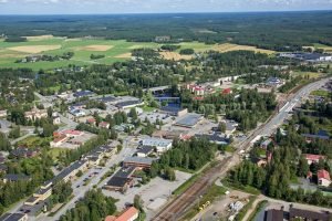
Kannus is a youthful town of many opportunities, located in Central Ostrobothnia in Western Finland. The municipality of Kannus was founded in 1859 and in 1986 Kannus received the status of town. Nowadays the number of inhabitants is 5646 (31.12.2014) and the surface is 510 km².
The nearest airport in Kokkola-Kruunupyy is 63 km from Kannus and the nearest seaharbor is located in Kokkola Ykspihlaja. Distance between Kannus and Helsinki (capital city of Finland) is 510 km.
There are several industrial and commercial activities in Kannus. The Commercial structure contains about 12 % primary production, 28 % processing, 59 % services and 1 % other industries. Local entrepreneurship is advanced, nationwide and employmental. The most important lines of business are wood processing, food manufacturing industry, construction, transportation industry, agriculture, fur industry and welfare services. Personnel of high-quality in research and educational units provide needed services for commercial life and companies.
 Pouttu Oy is one of the oldest companies in Kannus. The company was founded in 1938, and it produces several kinds of meat. The company has approximately 240 employees. Kannustalo Oy was established in 1978. Kannustalo Oy is specialised in the construction of traditional houses. It is a family company and it has approximately 120 employees. The company has won the public award five times at a national contest for house designers. The Kitinkannus is founded in 1990 and offers treatment and rehabilitation services for war veterans and invalids. Kitinkannus also offers health and wellness for all other people in the area.
In Kannus there is a Forestry Research Institution that is part of the Ministry of Agriculture and Forestry. The KannusRuralInstitute Academy offers basis agriculture education. Kannus also has four comprehensive schools for grades 1-6, one comprehensive school for grades 7-9 and a high school.
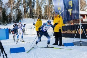
 The leisure activities in Kannus are exceptionally good when considering the size and population of the town. The leisure facilities in the beautiful pine terrain of Kitinkangas offer great opportunities for practising all kinds of sports. There is a swimming pool, a large gym and fitness building. Moreover there are good outdoor facilities, such as an athletics track, a cross country and a jogging track.

France
Cissé
Cissé is a 1600-acre semi rural community, located in west-central France. There are 2,700 inhabitants at the heart of this agricultural plain; Cissé is a rural community with large grain farms, and also an urban centre with a lot of people living in Cissé but working outside the village.
 Distant from all borders, but easy to access because it has a strategic position. Situated 13kms from Poitiers, it benefits from the proximity of the motorway A10, T.G.V. Paris-Bordeaux, and an airport.
There is interesting heritage all over the territory, with beautiful traditional houses, a church dated to 12th century, crosses and many wells
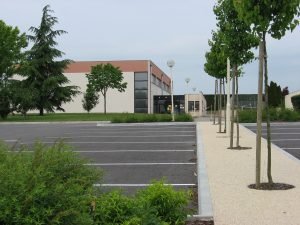 Town hall, schools, essential services and a lot of community associations offer a good living environment.
The socio-economic diversity of the population enabled Cissé to have a European vocation and to create a friend partnership with countries all over Europe.
 1989: It started with 11 communities representing Germany, England, Belgium, Denmark, Spain, Greece, Ireland, Italy, Luxembourg, the Netherlands and Portugal. On June 25, 1989, 100 Europeans came to Cissé and were hosted by families. It was the beginning of “The Charter of the European Rural Communities”.
 1995: 3 new countries: Austria ,Finland and Sweden arrived in the European Union and the Charter as well. The signing took place in Cissé.
2004: 10 new countries from Central Europe joined the European Union and the Charter as well: Cyprus, Estonia, Hungary, Latvia, Lithuania, Malta, Poland, Slovenia, Slovakia, Czech Republic.
 2008: the entry of Bulgaria and Romania before the arrival of Croatia a few years later.
With all the mayors, Cissé built the frame work of the Charter with group meetings (9 towns), young meetings (28 towns) and general meetings (28 towns), on a specific topic related to the European Commission. And all this unique organisation in Europe led the European Commission to award the “Golden Stars of Twinning” that were given 3 times in to the Charter: Strasbourg, Brussels and Ferrara.
Let’s go on with this great friendship and solidarity!

Germany
Hepstedt
Hepstedt is a village, situated in the north of Germany between Hamburg and Bremen. It is surrounded by forests, fields and meadows
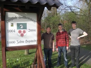 Hepstedt was founded more than thousand years ago.
About 1000 inhabitants live in this small village, where in former times almost all of the people lived on agriculture. Nowadays five big farms and some businesses of manual worker as painter, carpenter, roofer, car mechanic etc. exist. A farmer-shop offers some groceries and in another shop you can buy flowers and gifts.
In Hepstedt customs are practised the whole year, as the harvest festivals and different festivals of the community.
You can find here an intensive commitment to the European idea. One group, for example, called “Friends of Europe” supports voluntarily projects of the district council.


 At the heart of Nagycenk lies the Romanesque parish church dedicated to Saint Stephen, adorned with the Széchényi family crest, emblematic of their influence. The village celebrates its heritage annually with the Nagycenk Harvest Festival, a testament to its agricultural roots.
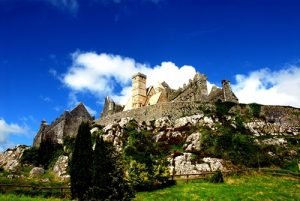 Dominated by the imposing St. Patrick’s Rock, a collection of medieval Ecclesiastical buildings, dating from the 10th to the 15th Century, this National monument overlooks Cashel. It was the site of the coronation of the kings of Munster, the southern province of Ancient Ireland and the seat of the Bishops of Cashel, which has given Cashel its claim to be “The City of the Kings”.
 The modern town of Cashel grew up below the St. Patrick’s Rock and its early commercial boundaries were established in 1319 when the town’s walls were built, some of those medieval walls are still extant and are celebrated in a Heritage Festival each year.
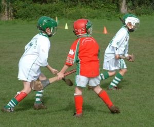 Sports include: Gaelic Games, Horse Racing, Rugby, Soccer, Handball, Golf, Tennis and Angling, all can be enjoyed locally. There is a vibrant and varied musical culture, Irish traditional music is taught and performed at the Brú Boru centre. There is a long established Pipe Band and a Brass Band; there are choirs and an Amateur Dramatic society as well as a Pantomime Society and a number of Irish Dancing schools.
 The town has a number of active community volunteer groups such as: the Irish Country Women’s Association, The Tidy Towns, Men’s Sheds, Active Retirement, Fair Trade, Lions Club, and Conradh na Gaeilge (an Irish language conversation club).
 Moreover traces were left of the Etruscan and Roman civilization, of the Medieval castle system and of the net of small settlements, together with abbeys, along the small rivers. To end with the Modern age and the development of the farming activity.
 Welcoming towers, castles and abbeys capture the imagination of their visitors with their references to the past. Moreover traditional values and healthy country life have been preserved by the development of the rural tourism.
 Kandava boasts the oldest boulder bridge in Latvia and a powder tower from the times of Duke Jekabs. Established next to the Old Town Square, the Promenade has become the heart of the place. This is a place to gather and socialize, relax and celebrate for both townsfolk and visitors; this is a place for families with children to spend quality time together. It is also intended to set up a workshop for craftsmen alongside with a gift shop, and a cosy café will find a place within the old stone walls.
 Kandava and a part of the Kandava municipality are situated in the nature park of the ancient Abava river valley and in the territory of cultural history “Abava valley”.
 It was formed Kandavas novads- first county in Latvia. It’s been 18 combined living and farming years. The number of years is not great, but important, because people have learned to live together, work together and jointly think about the future.
 In the Hall of Žagarė Manor Estate the famous Lithuanian singers, groups and a Choir “Brevis” made their performances. The ceremony was finished by colourful fireworks.
 This project is dedicated not only to local and regional communities but also to all Europeans. The main and biggest events of ‘Žagarė – Lithuanian Capital of Culture of 2015’ are Žagarė cherry festival that became a beautiful tradition and annual meeting of Charter of European Rural Communities.
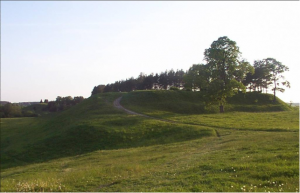 In 1198 Žagarė was mentioned for the first time in historical documents as Sagera, but according to the VI-IX century archaeological remains the Lithuanians lived here earlier. Žagarė was established in the Lithuanian part of the historic lands of Ziemgala near the two hills – Raktuve and Zvelgaiciai which were defensively very important. The castles on hills and the defenders were mentioned in the written documents of the early IX century. In XVI century official documents Žagarė was mentioned as a town. The river Svete acted as a natural divide between Old and New Žagarė.
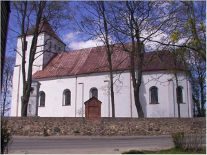 The two silver keys in the red field in the coat of arms of Žagarė symbolizes the union of two cities (Old and New Žagarė). The red colour is a symbol of bravery and shed blood for the motherland, the silver one symbolizes innocence, honesty and conscience.
 The centre of Žagarė town – famous for its urban and unique architecture. The Old Žagarė is announced as urbanistic monument. The XVI century main street networks, urbanistic architecture, stoned roadway, red-brick houses are saved till nowadays.
 The remote town in the north of Lithuania, close to the border with Latvia, is blessed with great natural beauty (such as Dolomite Rock Exposure, Žagarė Ridge, Svedpolis Spring, Svete Explosure, Rakte mound, the Mound of Zvelgaitis) and its ancient architecture (Žagarė Mansion House, Žagarė windmill, The Motor Mill, The Church of St. Peter and Paul in Old Žagarė, The Church of St. Peter and Paul in New Žagarė, The Barrows of Žagarė and The Old Jewish Cemetery, etc.)
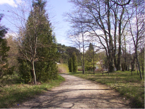 Žagarė manor House mostly is called Naryskinas mansion house. Classical-style mansion house was built in the 19th century. At the end of 2014 it was completely reconstructed.
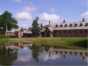 In the town locate such institutions as gymnasium where children gain a secondary education, sports and art schools, a special boarding-school for children who have mental disability, the centre of social services, cultural centre, the health centre, post-office and police station. The natives of Žagarė actively participate in social and cultural activity.
 A 1906 topographical map shows the radical transformation experienced by the village of Troisvierges (“Ulflingen” in German, and “Elwen” in Luxembourg dialect) from purely rural village to trading place. The Franciscan church of Troisvierges, built in 1658, with the oldest organ in the country, is a historic building of value with baroque furniture and paintings of Rubens as well as the statue of the Three Virgins (Trois Vierges).
 The biggest part of the population was railway and customs employees. The booming and lively village had 1.550 inhabitants in 1910. However, in the aftermath of World War II, the population increased dramatically (less than 1000 inhabitants in 1980!). Fortunately, this negative development stopped in the 1990s, mainly following the establishment of new businesses. The authorities had set up industrial and residential areas, which would have an immediate and positive impact on the population growth of this old rail hub, where the railway has lost much of its past significance.
 Nadur’s emblem shows the sun emerging from the sea with the motto “Vigilant”, which means “watchful against danger”.
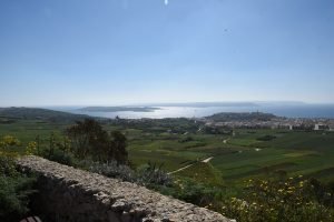 Nadur happens to be one of the most localities in Malta with a long tradition of immigration. Thus, wherever you are in Nadur, you can notice foreign flags flying on top of private houses. The US, Canadian, Australian and British flags clearly highlight Western ties and show signs of returning immigrants.
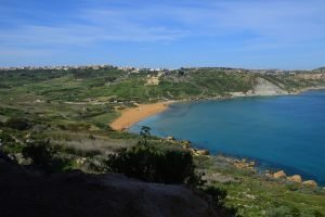 One can still find a lot of farmers and seafarers in Nadur. Quantities of fresh fruit like apples, peaches, pears, plums, oranges, lemon and melons from the fields of Nadur are distributed around all Malta and Gozo. Along Nadur’s coastline one can see the peaceful bays of San Blas, Dahlet Qorrot and Ramla. Dahlet Qorrot is a delightful small bay from where a lot of fishermen set sail every day.
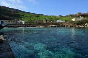 The picturesque boathouses in Dahlet Qorrot were converted from the original caves and ledges underneath the cliffs. It is a wonderful place for all those who love a quiet spot.
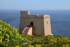 Ta’ Sopu Tower lies half way through Dahlet Qorrot and San Blas. As the village motto has it, Nadur is in itself a watch house for the island. The Nadurin were watchful sentries who could spot danger in time and call the alarm. There is another tower known as Kenuna Tower. This was built in 1848, and served as a telegraph link between Malta and Gozo and not as a fort. Recently Kenuna tower was completely restored and is now serving for communication purposes.
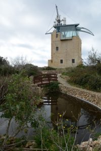 The picturesque boathouses in Dahlet Qorrot were converted from the original caves and ledges underneath the cliffs. It is a wonderful place for all those who love a quiet spot.
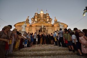 The feast of Nadur “Mnarja”is celebrated on the 29th of June and by the 1720’s a beautiful area known as “Il-Buskett” (meaning little forest) was the site of the celebrations. The feast was very popular with honeymooners and its name seems to suggest that there is a possible connection with the beginning of Summer. It is derived from luminaria (illumination), and in fact it is a festival rooted in Maltese seasonal rituals and customs.
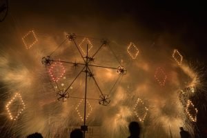 Although very popular, with various celebrations including various band marches, firework shows and an agricultural fair, the Mnarja feast is not the only thing going on in Nadur. In February, the Nadur Carnival, or more specifically, the Nadur Spontaneaous Carnival, takes place.
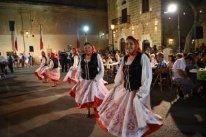 A multitude of people wearing all kinds of funny and grotesque costumes and floats take over the main streets of Nadur, and this event marking the beginning of lent is incredibly popular with not only locals but foreigners as well.
 Other activities in Nadur include a large number of religious processions throughout the year, a weekly market, a wine festival held every September, various activities related to the Council Week in November, as well as a Christmas concert in December.
Netherlands
Esch
 Esch, nestled in the heart of the Netherlands’ Noord-Brabant province, has a rich history and a vibrant community. Originally mentioned in ancient certificates as ‘Hesc,’ the village has roots dating back to Roman times, owing its early settlement to its strategic location near converging rivers.
Famous for its Roman tombs unearthed between 1950 and 1961, Esch boasts archaeological treasures, including a sepulchre housing artifacts like the amber figure of Bacchus, now showcased in the Noordbrabants Museum. The village’s medieval heritage is evident in landmarks like the Gothic church tower and the historic guild of Sint Willibrord, which celebrated its 400th anniversary in 1997.
Despite its small size, Esch offers a variety of leisure activities, with clubs for sports, music, and more. The village’s community center hosts numerous events, fostering a strong sense of community among residents.
 Esch’s annual Beer Pump Festival on Ascension Day is a highlight, welcoming new inhabitants with lively music and local brews. Additionally, Esch takes pride in its role as a founding member of the Charter of European Rural Communities, having hosted the network’s presidency twice in its history.
Now part of the municipality of Boxtel, Esch continues to thrive as a picturesque Dutch village, cherished for its history, community spirit, and vibrant cultural scene.

Poland
Strzyżów
Strzyżów is a small place in the province Podkarpacie. It has 8600 inhabitants. It is the largest place in the municipality and since 1999 also the capital of the region. The municipality has, besides Strzyżów, 14 others small villages and a total surface of 140 km2 with 21,320 inhabitants. The region of Strzyżów has a rural character, typical for southeast Poland.
 The patron of the city – St. Michael – is described as a soldier with a shield in his left hand and sword in his right hand. St Michael stands on a dragon, which he has just killed.
The first written reference to Strzyżów is from 1297. Since then the town was several times burned, plundered, destroyed and rebuild. Sa a large number of historical attraction from different centuries are located in the area of Strzyżów, such as: a Roman Catholic Church, a wooden Greek Catholic Church, a Jewish Synagogue, places and two underground forts from the Second World War.
Strzyżów has a splendid landscape. It lies in the valley of the Wislok river. New houses are built on the hills around the old core.
 The municipality has many facilities for recreation. The guests and inhabitants can relax in two stadium, sports halls, tennis courts and riding school. There is a ski area for winter and swimming pools for all year. Every year more and more agro-farm with rooms for rent are opening. Except accommodation you can find here homemade dishes, honey, milk products, fruits and vegetables.
Furthermore there are recreation cycle paths.
 Strzyżów has a cultural center, a library, a regional museum and local artist association. Moreover Strzyżów has restaurant, bars, train and bus stations.
The inhabitants can be characterized by their typical Polish hospitality, by their mutual solidarity, by their respect for national traditions and pastimes.

Portugal
Samuel
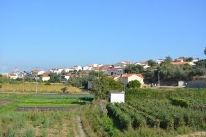
The Parish of Samuel is located in the Central Region of Portugal, in the sub-region of Baixo Mondego, next to the municipalities of Figueira da Foz and Montemor-o-Velho, and consists of a predominantly agricultural and forest area, in which highlight the culture of rice and olive oil.
The Parish of Samuel is the second largest of the municipality with 31.4 km2 in area, 1300 inhabitants and 22 small towns.
Although the first written news concerning Samuel is from 1258, the material traces trace back the occupation of this territory to the Neolithic; This was verified given the exceptional conditions that Man has found here to settle: the proximity of the sea and the countryside, and the existence of thermal waters, would have been elements that made a fundamental contribution to this fixation.
Having belonged to the Seiça Monastery, it was, for a short period of the last century, the seat of the Council, having moved to the Soure in 1853.
In the golden age of thermalism, the Alder, Azenha and Bicanho Fountains were important poles of economic development; Today, agriculture plays a major role in the local economy, despite the existence of small industrial units.
Since 2015, the Bicanho Hot Springs have been reactivated.

Romania
Ibănești
Ibăneşti, nestled amidst the scenic Gurghiu Mountains and blessed with the tranquil Gurghiu River flowing through, exudes natural beauty and cultural richness. The village, steeped in tradition and adorned with picturesque landscapes, offers a warm welcome to visitors, inviting them to partake in its vibrant community life.

Nature has bestowed Ibăneşti with diverse terrain, from lofty mountains to rolling hills and lush plateaus, fostering a rich biodiversity. This natural splendor is complemented by the village’s ethnographic wealth, with residents proudly preserving customs, traditions, and folk arts. Hospitality is ingrained in the local culture, with invitations to share stories and experiences extended generously to all, including newcomers.
The Gurghiu Valley, home to Ibăneşti, teems with wildlife, from majestic deer to elusive lynxes, thriving in the valley’s varied ecosystems. Hunting, once a regal pastime attracting dignitaries and leaders, now occurs under strict regulations, ensuring the conservation of the valley’s natural treasures. The pristine waters of the Gurghiu River harbor a plethora of fish species, offering a haven for anglers and nature enthusiasts.
Nestled amidst the forested heights at 815 meters above sea level, the Lăpușna Hunting Castle stands as a testament to the village’s regal history. Built in the early 20th century, the castle hosted royalty and dignitaries, including notable communist leaders. Nearby, the Saint Nicholas Wooden Church, dating back to 1779, showcases exquisite craftsmanship and serves as a spiritual sanctuary for locals.
Traditional craftsmanship thrives in Ibăneşti, with skilled artisans like Petruţ Chirteş preserving age-old woodworking techniques, crafting intricate church objects and roadside crucifixes. Visitors can immerse themselves in the village’s rich heritage at Dumitru Suceava’s household, where a functioning whirlpool offers a glimpse into bygone domestic traditions.
The village’s cultural vibrancy extends to its attire, with women proudly donning intricately embroidered traditional costumes during festivities and cultural events. Meanwhile, culinary traditions flourish, with local delicacies like Telemea de Ibăneşti cheese and Lăpuşna beer delighting palates with their authentic flavors.

Each year, the Gurghiului Valley Festival celebrates the region’s heritage, drawing participants to the picturesque Plateau of Fâncel. Here, amidst breathtaking landscapes, visitors can immerse themselves in local customs, indulge in traditional cuisine, and revel in the vibrant atmosphere, experiencing the essence of Ibăneşti’s cultural tapestry.

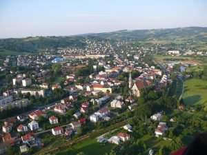
Slovakia
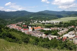
Medzev
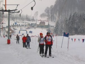
The town is situated in the east of Slovakia and lies in a pictures valley. It is surrounded with beautiful mountains (1200 meters above sea level), with rich wild life and fauna.
 The town is one of the gates in to the National park Slovak krast. There are 700 caves and abyss.
The history at the town dates back to the 13th century. German colonists established the town in 1241 after the Mongol invasion under the rule of Bela IV.
 The Roman Catholic church from 15th century has been rebuild in 1753 in todays baroque style. In 1892 a fire destroyed the tower, roof and bell tower. In 1932 gained today’s looks.
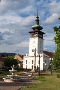
In the centre of the town is a baroque pillar from the 18th century.
The most iconic for our town is historic technical sight the blacksmith forges which is water powered. In there our ancestors produced tools for the farming industry.
 Copper and iron ore was mined in the local minds and the country was rich of natural water resources. These forges date back to 1376.
The biggest boom of the blacksmith industry came in the last third of the 19th century, when there were 109 blacksmith forges with 198 fireplaces in operation in the surrounding creeks.
The local black smiths were producing tools which were of high quality and were sold all over Europe.
 Today is Medzev the small town, with good infrastructure. We have a school, nursery, high school and great art school with 500 pupils. The town has a engineering industry, health centre, cafés, shops, restaurants, banks, a doctor, a dentist, a police station, post office, etc.
In the last decate the town underwent an intensive development in the field of infrastructure.
In our town we have a rich cultural and sport events.
Apart from sports of every type like football, handball, table tennis and a tests of strength, we have every year a traditional half marathon competition.
Our clubs present traditional culture such as Karpatian German Association with singing and dancing elements, brass band, accordion band and other group, which performed our culture.

Spain
Bienvenida
We don´t really know the exact origin of our name: Bienvenida. But everyone who visit us can confirm that it is a good selection: Bienvenida is a warm, friendly and cheery municipality. Gastronomy and cultural heritage are some of our charms, but don´t trust us; you need to check it: come and feel yourself… Welcome!
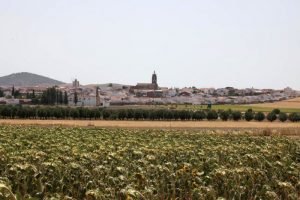
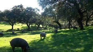 Bienvenida is located in the southwest of Spain, in the region of Extremadura, close to Portugal. The landscape is defined by fields of vineyards, olives, cereals and grasses. The vegetation is composed of remnants of Mediterranean woodland, represented by the oak and cork with other species such as rockrose, gorse, lavender…
 You can access through the exit 700 of the highway A-66 to the Road Home (EX-202). You can also access via the national road N-432 Badajoz-Granada, to the junction with the district Bienvenida to EX-202.
Data are available from the existence of Bienvenida prior to the year 1351. We found some remains of Roman settlements in different parts of the municipality while the village comes to the process of Christian reconquest and repopulation by the Order of Santiago.
 Our town is also known for being the birthplace of the dynasty of the bullfighter Manuel Mejías Rapela, its founder. It is the most important Dynasty in the story of bullfighting, and there is a beautiful Museum in our village for reminding this big and important family.
 Pilgrimage of Saint Isidro (May 15). It is celebrated for several days in the field (Pradera de San Isidro), where everybody can mix faith and fun for 3-4 days. Two weeks before, Saint Isidro is moved in procession to its sanctuary in the prairie. Everybody joins this procession in a very festivity day.
On Easter, attractions steps away from the traditional processions, especially on Good Friday procession of the Holy Burial in which “Benedictine group” sings Gregorian chants. It is interpreted by ordinary people, with very singular latin tones with flamenco details.
Home Fair, held the first weekend of August.
Festivities in honour of Our Lady the Virgin de los Milagros, on September 8.
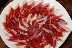 The typical dishes of the locality are related to the Iberian pig and lamb: chanfaina, caldereta. Our landscape is ideal for the Iberian pigs, and we have the best Iberian ham and meats of Spain.
There are also lots of famous and tasty sweets: empanadilla, spirals of glory, flaky almond and traditional rosquetes and buns at Easter.

Sweden
Ockelbo
In Ockelbo we give priority to the green, natural and growing,
We welcome – we stand for a safe and welcoming society
We grow- we allow people to grow and prosper together
We collaborate- we interact with others, both locally, regionally and globally
Ockelbo is a small municipality with almost 6000 inhabitants in northern Gästrikland.
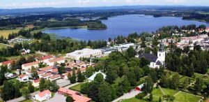 The oldest traces of settlements are from the Iron Age. We are at the north- south border of attractive scenery between vast golden fields, blue tinged mountains and deep green spruce forests. There are conditions and opportunities for your growing here. If you are here for a day, some days, or why not the rest of your life, you will always have a chance to get nourishment and inspiration.
A green life among the most well composed gardens, the friendly districts, the wildest we have; the deep forest animals. Genuine experiences we can offer both in enjoyable and educational forms at the place where the winter is always winter and summer is always summer.
With our good communications it is easy to reach Ockelbo, but we are far enough away so that you as a visitor feels away for real.
Wij Gardens is bursting with life, discovery and pioneering spirit. All your senses will be appealed when you walk through this destination with display gardens, sale of plants, food, gardening and crafts. It also offers art exhibitions, events and courses.
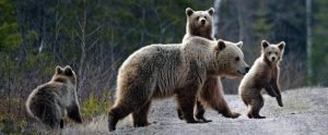 They are there in our forests, wild animals and predators.
The elk may be shy, but in our Elk Park you can get really close to them. The many lakes and streams also provide excellent fishing possibilities.
 In Ockelbo you can go swimming in one of our lakes or visit our indoor swimming pool. There is also opportunities such as riding school, ski trails and running tracks, ski slope in Rönnåsen which also offers archery, biathlon and mountain biking.
 There are an unusually high number of small and medium enterprises which form a solid base in the municipality. Historically the most important industries came from the people in Ockelbos ability to work with the natural resources: iron and forest. Nowadays there is a great variety among the companies. Plastics Companies producing plastic parts for appliances, vehicles, and water slides that are exported around the world. Carpentry delivers special windows and other woodwork throughout the country.
High-tech measuring instruments are developed and manufactured in Ockelbo. Our food business produce and process local products and some are to be served at luxury restaurants. Ockelbo is also the purveyor to the royal court of a living prince.

United Kingdom
Desborough
Desborough is an historic Market Town in the heart of England, located in the Ise Valley in the Midlands county of Northamptonshire. With more than 10,500 people, Desborough has grown rapidly over the past few years with hundreds of new homes being built in the town, attracting new business and industry to the area. Many people also travel to work in larger surrounding towns including Kettering, Corby, Leicester and Northampton with excellent road links from the town to all parts of the UK.
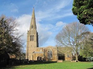
 Desborough can trace its history back to the Bronze and Iron Ages, as can be seen in archaeological artefacts including the beautiful Celtic design Desborough Mirror dated from the 1st Century AD and now on display in the British Museum in London. There is a reference to the town as “Disburg” in the Domesday Book of 1086, and the oldest surviving building is St Giles Church built in 1223.
 Visitors to the town are also welcome to explore our countryside, and historic nearby attractions including the Elizabethan buildings of Triangular Lodge and Rushton Hall in the nearby village of Rushton.
In the 17th to mid-19th Centuries Desborough was at the centre of spinning and weaving of woollen and linen fabrics, and then silk, resulting in the production of fine lingerie which exists to this day. The County is world-famous for its footwear production, and high-end manufacturers like Joseph Cheaney shoes remain in the town.
Desborough has its own Town Council, and is part of the larger administrative Borough of Kettering (c. 80,000 inhabitants). London is just one hour away from nearby stations by train; Cambridge, Birmingham and Stratford-upon-Avon and many other places of interest are within an hour by road.
 The Town Logo is based on the historic Town Cross – actually an obelisk from Harrington Hall which stands on the market square on the High Street. Charter activities are run by the Desborough & District Twinning Association on behalf of the town.